
Drone panoramic aerial photo of Newcastle East, 2300, Australia
Photographer:
Mike Swaine, Above Photography
(Hire this photographer)
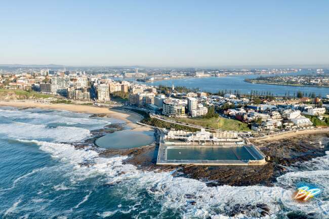
1.47 Km to Newcastle in New South Wales Australia, Australia, New South Wales, Newcastle, geo:lat=-32.936440, geo:lon=151.787670, geotagged. Perfect sky-high photos are often hard to search for. That's why AeroStock has compiled a huge stock library of millions of snapshots taken of NSW and all over Australia. This 2010 snapshot from the sky the Newcastle region shows Newcastle East from an altitude of 100000 meters.
| Photo ID | 31302 -25 |
| Licence type | Royalty-free |
| Location | Shortland Esplanade, Newcastle NSW 2300, Australia |
| Taken | 2010:06:11 10:22:02 |
| Camera | Canon EOS-1Ds Mark III |
| Shutter speed | 1/1250 |
| Aperture | f/11 |
| Focal length | 60mm |
| ISO | 800 |
| Altitude | 100000 |
| Sequence | NC 00123010 |
Color palette
#3f4744 #a6b1bc #bfb7b3 #8a8178 #969da8 #6c8282Locations near Newcastle East
- The Hill
- Newcastle
- Cooks Hill
- Bar Beach
- Newcastle West
- Stockton
- The Junction
- Carrington
- Wickham
- Hamilton East
- Merewether
- Hamilton South
- Hamilton
- Maryville
- Islington
- Tighes Hill
Similar photos
NC 00123011

NC 0123010

NC 00123012

NC 0123012

NC 00123013

140318 114140 Camera3 06788

140318 114140 Camera2 06787

NC 00123009

140318 114139 Camera1 06785

131108 082243 Camera3 03156

131108 082243 Camera5 03158

Newcastle 2300

131108 082243 Camera4 03157

131108 082242 Camera6 03154

NC 00123008

NC 00123007

NC 0123007

140318 114137 Camera4 06782

140318 114150 Camera4 06789

NC 00123014

NC 00123015

NC 0123015

NC 00123006

140318 114153 Camera1 06792

140318 114153 Camera2 06793

NC 00123017

NC 00123018

NC 00123016

NC 0123018

140318 114153 Camera3 06794

NC 00123005

131108 082253 Camera6 03166

Newcastle 2300

131108 082253 Camera4 03164

Newcastle Ocean Baths
131108 082253 Camera5 03165

131108 082233 Camera8 03152

131108 082233 Camera3 03148

131108 082233 Camera5 03150

131108 082233 Camera4 03149
